 Ukraine
 Poland
 Slovakia
 Українською
Transcarpathian region
Zakarpattia Oblast (Transcarpathian region) is located in the Southwest of Ukraine. In the north it borders on Lviv, in the east on Ivano-Frakivsk oblasts of Ukraine, in the south it borders on Romania, in the southwest on Hungary, in the west on Slovakia and in the northwest on Poland.
The administrative centre is the city of Uzhgorod.
The majority of national composition are Ukrainians: in the northwest, there are ethnical groups of Boykos and Lemkos, in the east — Hutsuls. Hungarians, Russians, Romanians, Slovaks, Germans and Gypsies also live here — in all more than 30 nationalities.
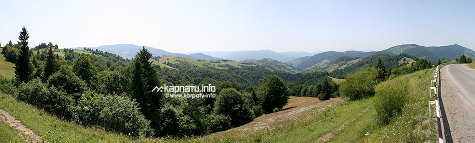
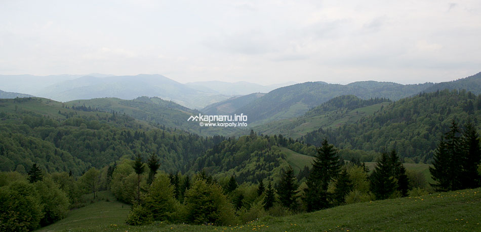
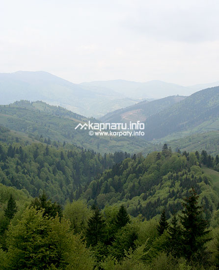
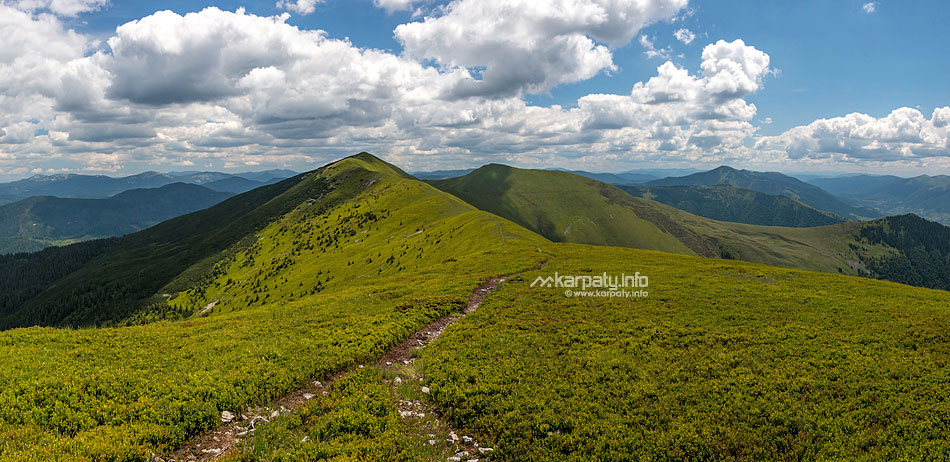
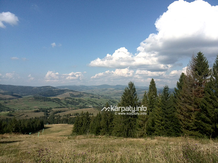
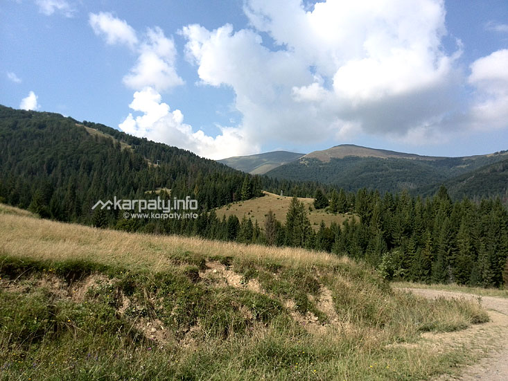
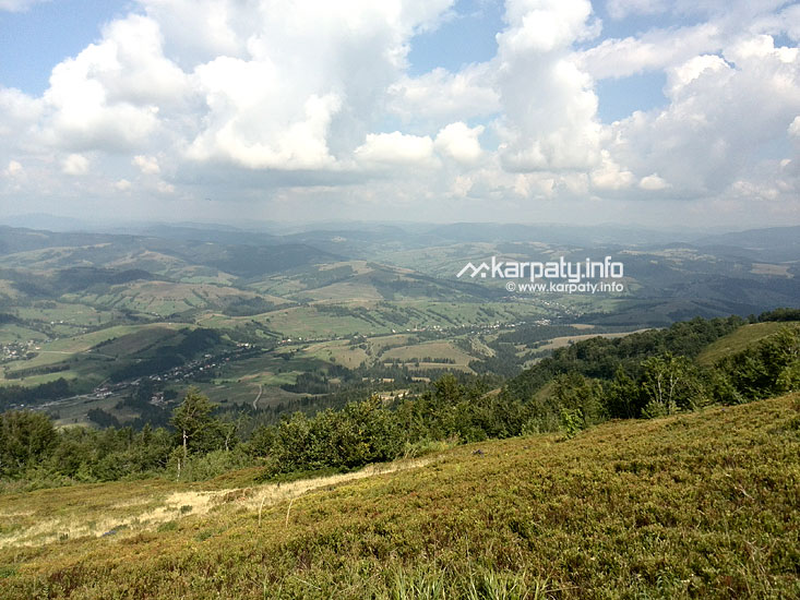
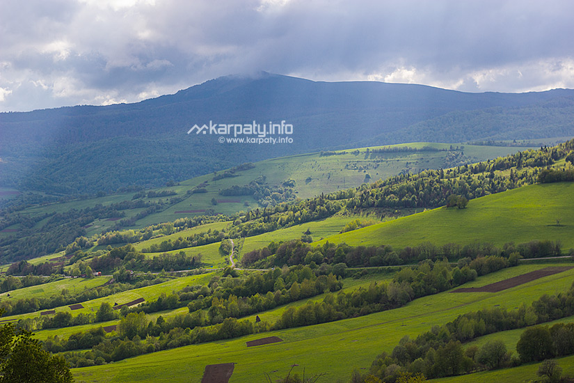
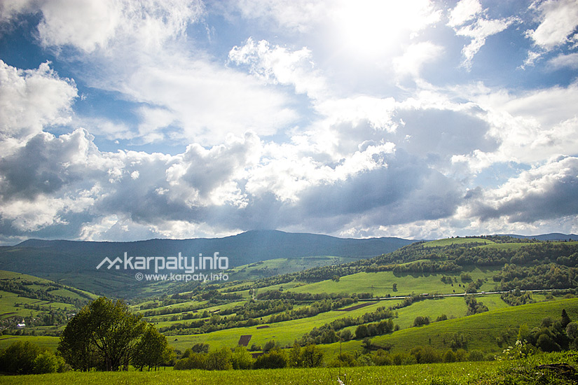
About 80% of the territory of this land is occupied by mountains, creating from the southwest to the southeast the Vododilnyi mountain range, the Gorgany, the Svydovets, the Chornohora, the Polonynskyi range, the Rakhiv Massif and the Volcanic Carpathians. In the Chornohora mountain range, there is Mount Hoverla (2061 m) that is the highest peak of the oblast and Ukraine. Transcarpathia is joint with other regions by the Yablunytskyi, Vyshkivskyi, Uzhotskyi, Veretskyi and Volovetskyi passes of an altitude from 931 to 1014 metres above sea level. The southwestern part of the oblast is covered with the Transcarpathian Lowland (100-120 metres above sea level).
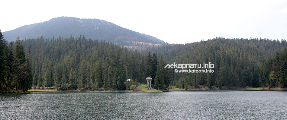
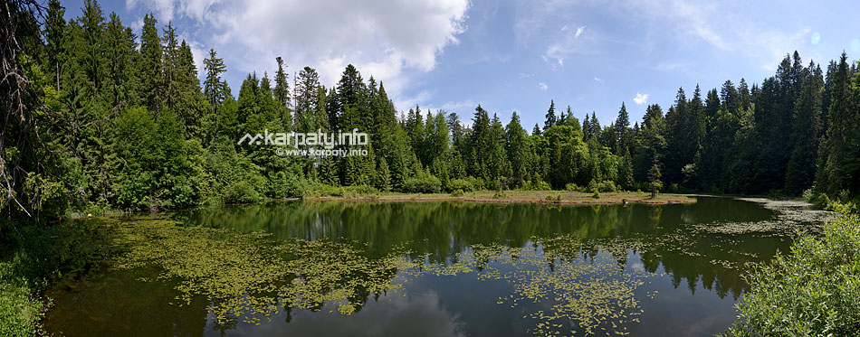
9429 rivers and streams flow through the territory of the oblast. The Tisza (the Danube's left tributary) is the longest river. Within the territory of the oblast, its length is 240 km. The longest tributaries are the Borzhava, the Rika, the Tereblia and the Teresva. The next largest rivers are the Latorytsia and the Uzh that fall into the Bodroh river. In the oblast, there are 137 natural lakes, in particular of glacial and landslide origin, Synevyr is the largest of them.
Useful minerals of the oblast: deposits of polymetals, alunites, perlites, zeolites and rhyolites, the Solotvyno rock-salt deposit is considered to be important; kaolin mining is carried out here, 13 deposits of carbonate raw materials (marbled limestone, dolomite, marble) were found. More than 360 mineral water springs different in chemical composition and medicinial properties were discovered and examined
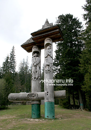
In the territory of Zakarpattia oblast, near the village of Dilove, Rahiv district, there is the geographical centre of Europe.
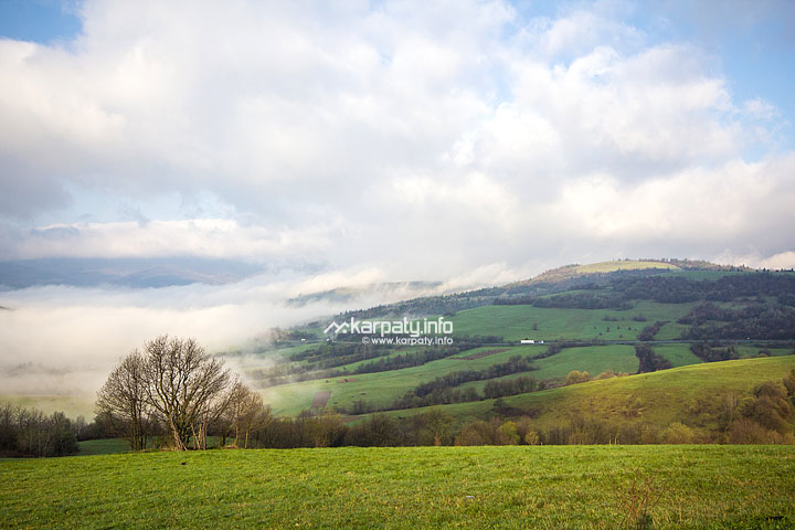
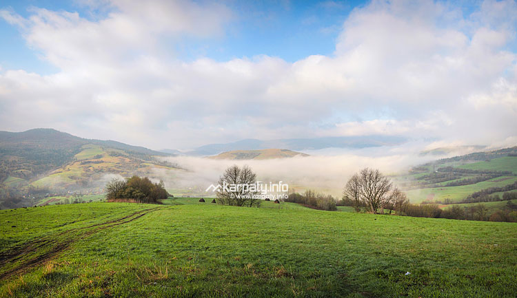
The climate of Transcarpathia is temperate-continental, and the very word "temperate" in this term corresponds to reality. Here, there is nothing too much or too little: there is enough sun in summer and enough snow in winter, and the interseasonal weather doesn't tend to cause such damage as steady rains. Within the territory of the plain, air gets warmer during a year than in the mountains. In July, an average temperature is +20°С, and in January – -4°С. In general, the climate is much warmer than in other regions of Ukraine, located at the same latitude.
The first account about human habitation in the territory of Transcarpathia refers to the Lower Paleolithic Period (about 1 million years BC). In the 3rd century, the Carpi, one of Thracian tribes, moved here from the valleys of the Siret and Pruth rivers under the pressure of Romans. In many scholars' opinion, the Carpathians took the name from this very tribe.
The history of Transcarpathia is a part of the history of Ukraine, and it has the whole range of features that have had an impact on economic, political and ethnic development of the land. Occupying an important geographical location on the southern slopes of the Ukrainian Carpathians, Transcarpathia that at different times had such names as "Hungarian Ruthenia", "Carpathian Ruthenia", "Subcarpathian Ruthenia" and "Transcarpathian Ukraine" had been a part of the Kingdom of Hungary, Austrian Habsburg Monarchy, Czechoslovak Republic and Horthy's Hungary by the middle of the 20th century. Due to this, Transcarpathia is a very peculiar Ukrainian region that has its own dialect, its own cuisine and other local features.
Transcarpathians are famous for their hospitality and multiculturalism. You can hear the Russian, the Ukrainian, the Hungarian, the Romanian and other languages here that sometimes mix with each other and create a local racy dialect.
Transcarpathia is the motherland of the world's famous artists as Ihor Hrabar, Adalbert Erdeli, Yosyp Bokshai, Fedir Manailo and Andriy Kotska. A lot of other artists such as composers Dezyderyi Zador, Stepan Marton, Yevhen Stankovych and singer Gizela Tsypola come from here.

Swim in thermal water in Berehove, Koson or Velyatyn.
See numerous architectural monuments and natural attractions — castles, palaces, churches, national nature parks and a lot of other attractions.
Walk around the old cities of Uzhgorod, Mukachevo, Berehove or Khust.
Taste different goodies — goat and sheep cheese, sausages, wine, fruit liqueurs as well as an extremely tasty and special local cuisine.
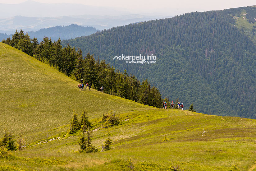
In winter — you should go skiing, in summer — go camping or ride a horse.
Wine cellars, Serednie urban village
Horyany Church-Rotunda, Uzhhorod city
Gothic of Potyssia: churches of Berehove, Vynohradiv district, Rakhiv, Tyachiv and Khust districts
Chapel of st. Joseph, Mukachevo city
Lemko churches: the Church of St. Nicholas (Svalyava) and the Church of St. Michael (Museum of Folk Architecture, Art and Life, Uzhhorod)
Shenborn Palace, the village of Karpaty
Former Casino (restaurant "Zolota Pava" ("Golden Peacock")), Berehove city
Perényi Mansion House, Vynohradiv city
Philharmonic building, former synagogue, Uzhhorod city
'Nialab', Korolevo urban village, Vynohradiv district
Palanok Castle
Sent-Miklosh castle
Dovzhanskyi castle, the village of Dovhe, Irshava district
Templars' Castle
Kvasivskyi castle, the village of Kvasovo, Berehove district
Nevytskyy Castle
Uzhgorod Castle
Fortress in Khust
Museum of Folk Architecture, Art and Life
Museum of Local Lore, History and Economy
Smithy-museum 'Hamora', the village of Lysychovo, Irshava district
Museum of Berehivshchyna
History museum in Mukachevo
Lemkivska Sadyba
Silver Land
Old School
Stare Selo (Old Village)
Valley of the Daffodils
Zacharovana Dolyna State Park (Enchanted Valley)
Brebeneskul Lake
Synevyr Lake
Pearl Cave
Cave with transparent walls
Beech virgin forests
Polonyna Runa (Rivna)
Salt Lakes
The most high-altitude city is Rakhiv. Its average altitude is 820 metres above sea level. This city has broken one more record — the biggest level difference between streets is 600 m: from the lowest street (400 m) to the highest one (1000 m).
The most highly located construction is five-metre-high Stella that was set in 1996 on Mount Hoverla where such national symbols as the blue-yellow flag and the Tryzub (the Trident) are located.
The longest tunnel is the railway tunnel located on the distance Skotarske–Beskyd, its length is 1747 m and it was built back in 1887.
The longest viaduct is the railway bridge on the distance Skotarske–Beskyd, built in the middle of eighties of the 19th century, its height is 33 m and length is 270 m.
The most highly located sports construction is a ski resort 'Drahobrat' that is located on the mountain valley of the same name (1450 metres above sea level) near the urban village of Yasinya. Uniqueness of this place is in the large amount of snow. Annually, a ski season starts here in December, and ends in May.
The most high-altitude lake is Brebeneskul that is located on the slopes of mountains Hutyn-Tomnatyk and Brebeneskul at an altitude of 1801 m; its square is 4 km2 and its maximum depth is 2,8 m.
The largest mountain lake is Synevyr in Mizhgirya district. Its square is 7 hectares, its depth is up to 24 m. It is called 'Synie Oko' ('Blue Eye'), 'Morske Oko' ('Sea Eye') or 'Carpathian Ritsa' by local people. A strong earthquake or, maybe, centuries-old weathering caused the landslide of rocks that stopped the outflow of a mountain stream and created the lake at an altitude of 989 metres above sea level.
Valley of the Daffodils near Khust is the only plain in Ukraine where white narrow-leaved daffodils grow in natural conditions. They look like garden daffodils, but the very flowers are bigger and sometimes their diameter can be 10 cm.
Near the village of Mala Uholka, Tyachiv district, in the valley of the river, there is an unusual rock Kamiana Brama (Stone Gate) that itself is a peculiar karst bridge in marbled limestones of the Jurassic period where karst processes have created the pass of 10 m in width and 3 m high.
A record-breaker in height among trees is the European larch in Rakhiv. When it was cut at the age of 140, it was 54 m high.
The main warning concerns time. Transcarpathians officially live according to current time in Kyiv, but actually — according to current time in Europe (it is called 'local time' here). That's why you shouldn't be surprised when you hear "6 o'clock Kyiv Time" or "5 o'clock Local Time" — other Ukrainians understand it as 6 o'clock.
If you plan to visit some village museums, you should phone and agree on the day beforehand because a worker in such places, as a rule, is the only one and he/she is not always there.
When a traveller sees the signboard "ABC" on grocery stores, he/she can think that it is a name of the local mini-market chain. Actually, small department stores in Hungary are called "ABC", that's why it can be considered as a general name. There are round-the-clock shops only in some cities, most often you can find them at such gas stations as "OKKO", "WOG" and others.
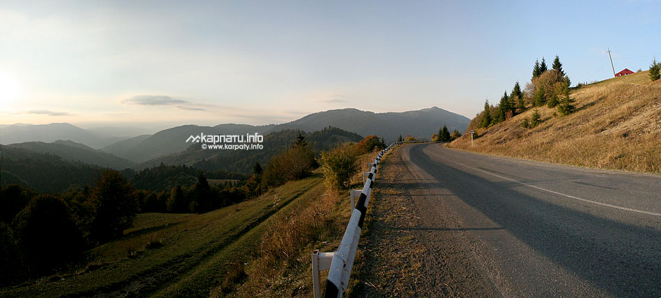
Railway and road network provides a good connection between the oblast and many districts of Ukraine as well as neighbouring countries. There is an airport in Uzhhorod.