Ukraine
 Poland
 Slovakia
 Українською
Torun
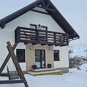
The village is situated in the mountainous area of Transcarpathian region, between the spurs of the Polonynian Beskids and Western Gorgany, at the confluence of the Rivers Torunka and Rika. The highest peaks in the vicinity are Hemba (946 mamsl), Pereniz (1070), Magura (1107), Smerek (1421). The population reaches 2,000.
Torun was first mentioned in 1646. Since then the name "Turun-Patak" began to appear in the documents, which was first used unchanged to denote a small mountain settlement, and over time evolved into "Toronya" and "Torun". Czech linguist Shmilauer V. (1895-1983) believed that this name evidently traces back to the Slavic lexeme "тоуръ", in other words “tur” (aurochs) – genus representative of the extinct European wild bulls (the last one was killed in 1627). Interestingly, even today, on the outskirts of Torun, the common name for one of the local natural landmarks is Turovo that in a way supports this idea.
There are many more folk versions of the village name’s origin. Among them:
- Derived from “arduously beaten (ukr. “protorovany”) track through the mountains”. Lots of merchants struggled through the mountain passes overcoming the obstacles and running the risk of encountering wild animals or bandits. Being too exhausted to proceed, they settled in this area.
- Derived from the name of the landowner Toron (although there is no documentary evidence).
- Some merchant took to the road with his son to teach him the trade. Making their way through the mountains and passes they found a river valley plain. The son asked, “What’s this?” The father answered, “To – Run” (That’s Run). And indeed, even nowadays in the village there is a place called Runi.
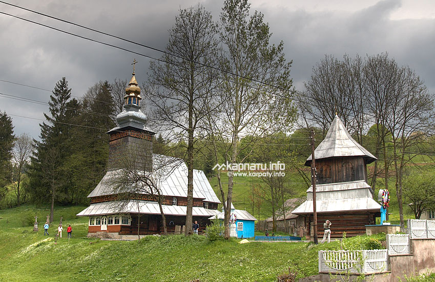
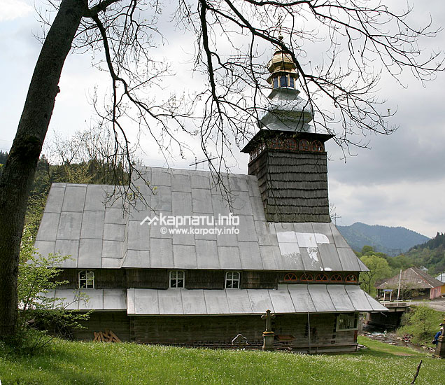
In the centre of the village above the river one can view wooden Church of the Presentation of the Blessed Virgin Mary (1809). The three-section spruce building features a smart Baroque tower on the outside and an antique iconostasis in the interior. A small wooden bell tower is nestled nearby. The site was chosen for a reason. Legend has it that earlier the church was on Prychil Mount. During strong wind, turna (the upper part of the roof) fell on the place of current church’s location.
Torun gave its name to the mountain pass that leads from Ivano-Frankivsk to Transcarpathian region. At the Torun mountain pass there is an Austrian military cemetery dating back to the WWI as well as a Hungarian pillbox of approximately 1940.
The village has also set a curious record for self-governance: village head Hanna Holovka has been leading the local council for over 30 years, since 1988.
On the outskirts of the village there are low wooded mountains rich in mushrooms and bilberry. Travelling by car, it’s easy to get from here to Carpathian Tram and Vyhoda NGR Heritage Centre, 10 museums village Kolochava, The Borzhava Mountain Valley and Shypot (Shypit) Waterfall. On the Torun pass there begins a hiking trail to Gorgany (red marker) with an offshoot to Synevyr Lake (blue marker).
| Service | Address | Phone number |
|---|---|---|
| Telephone number information centre | +38 (031) 99-109-11 | |
| Village Council | +38 (03146) 2-86-37 | |
| Ambulatory care | +38 (03146) 2-86-16 | |
| Mountain search and rescue service | 16/12 T. Shevchenko Street, Mizhgirya urban type settlement | +38 (03146) 2-23-45, +38 (097) 847-60-41 |